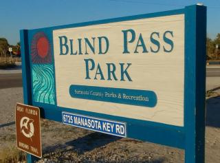
6725 Manasota Key Road
Englewood
Blind Pass Beach
![Park/Recreation Area: Green space that offers a place to relax and play outdoors. May include sports fields, picnicking, running paths, canoe rental, or workout/play equipment, along with diverse vegetation and a pond, creek or other water feature. Park/Recreation Area](https://www.opengreenmap.org/sites/default/files/taxonomy_image/category_pictures_94.gif)
![Waterfront/Riverside Park: Place where you can relax, walk or ride along and play by the water (includes water bodies of all types). May include a beach; swimming and wading may be possible. Waterfront/Riverside Park](https://www.opengreenmap.org/sites/default/files/taxonomy_image/category_pictures_62.gif)
![Water Feature: Display or drinking fountain, beautiful waterfall or natural pond. May simply celebrate water or offer a refreshing drink in an ecologically sound way. Water Feature](https://www.opengreenmap.org/sites/default/files/taxonomy_image/category_pictures_63.gif)
![Wildlife Habitat: Native environment for animals and the plants that sustain them. Can represent native natural environments, or protected areas such as park reserves where larger animals and other wildlife can be found. Wildlife Habitat](https://www.opengreenmap.org/sites/default/files/taxonomy_image/category_pictures_83.gif)
![Coastal Habitat: Places along the water's edge where wildlife congregates. Wildlife may be in or above the water, on the shore or on adjacent land. Sensitivity to delicate habitats should be exercised. Coastal Habitat](https://www.opengreenmap.org/sites/default/files/taxonomy_image/category_pictures_85.gif)
![Swimming: Safe, clean site for swimming or wading. This natural body of water or pool might not have a lifeguard, though. Swimming](https://www.opengreenmap.org/sites/default/files/taxonomy_image/category_pictures_98.gif)
![Canoe/Kayak Site: Boathouse, dock, ramp, rental shop or other site where you can launch a small human-powered boat into a body of water. Canoe/Kayak Site](https://www.opengreenmap.org/sites/default/files/taxonomy_image/category_pictures_99.gif)
Overview
Blind Pass Beach, also known as Middle Beach, is in between the Gulf of Mexico and Lemon Bay. It has a park, beach front, trails through mangrove forest, kayak launches, fishing docks, and bird watching. The mangroves are preserved to protect the land from erosion and the ecosystem supports many types of wildlife including crabs, birds, dolphins, and manatees. The docks and trash receptacles are made of durable, recycled materials and the park provides recycle, waste and fishing line disposal sites.
-Bryan Knight, student at SCF sustainability class
Location:
Javascript is required to view this map.
Comments
Connections
Compare related sites, explore the related maps, find out about volunteering, how to get here and more. Soon, you will find ways to share this map here, too.
Every site using the same primary Icon on Open Green Map is automatically linked here. You can compare different approaches and solutions on this map and others around the world.
Choose a connections category from the list on the left.
Other Sites on Map
- Englewood
- Englewood
Related Sites Worldwide
- PloverUnited States
- BaltimoreUnited States
-
-
- 台湾
- Brazil
- OaklandUnited States
- BucurestiRomania
- San FranciscoUnited States
- New YorkUnited States
- London
- United States
- SarasotaUnited States
- TartuEstonia
- Gwynn OakUnited States
- TartuEstonia
- BaltimoreUnited States
- San FranciscoUnited States
- AustinUnited States
- Brazil
- UrbanaUnited States
- AustinUnited States
- United Kingdom
- South Africa
- 台湾
Multimedia
![](https://opengreenmap.org./sites/default/files/imagecache/320max/user_upload/542354.jpg)
Blind Pass Beach
Impacts
No impacts have been left for this site yet - be the first!