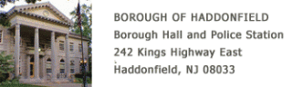
242 Kings Highway East
Haddonfield
NJ 08033
Borough Hall
Übersicht


Head of Borough Government and Haddonfield Police Station

Location:
Javascript is required to view this map.
Kommentare
Verbindungen
Compare related sites, explore the related maps, find out about volunteering, how to get here and more. Soon, you will find ways to share this map here, too.
Every site using the same primary Icon on Open Green Map is automatically linked here. You can compare different approaches and solutions on this map and others around the world.
Choose a connections category from the list on the left.
Andere Orte auf der Karte
n/v
Ähnliche Orte weltweit
- Brazil
- AkronUnited States
- CuritibaBrazil
- taoyuan countyTaiwan
- City-wideSouth Africa
- Atlanta, GA
- Spain
- DubuqueUnited States
- DickersonUnited States
- Taiwan
- FlorianópolisBrazil
- New YorkUnited States
- Spain
- CuritibaBrazil
- GoshenUnited States
- Cape TownSouth Africa
- Cluj-Napoca
- Taiwan
- Spain
- China
- Spain
- DetroitUnited States
- KincardineCanada
- New YorkUnited States
- Spain
Multimedia
Borough Hall


Auswirkungen
No impacts have been left for this site yet - be the first!


