Mary Scott Park
Descripción


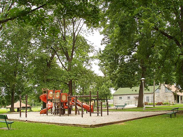
The Mary Scott Park features:
An open air-shelter
Picnic Area
Playground
Originally known as North West Seventh Street Park, Mary Scott Park became the first park located on the west side of Richmond. The history of the park started with the land being originally owned by the Peacock Family. The Peacock Farm extended from North west Fifth Street west to approximately North West Thirteenth Street on the north side of Main Street. The Farm was later broken up as Richmond began to expand west. The area was being developed as the Beeson & Sedgwick Addition. Within the area was a beautiful forest known by the citizens of the area as Middleton’s Woods. (Credit Waynet.org).

Location:
Comentarios
Conexiones
- Richmond
- Richmond
- Richmond
- Richmond
- Richmond
- Richmond
- Richmond
- OaklandEstados Unidos
- AustinEstados Unidos
- OaklandEstados Unidos
- New YorkEstados Unidos
- AustinEstados Unidos
-
- North CharlestonEstados Unidos
- Taiwan
- EnglewoodEstados Unidos
- BaltimoreEstados Unidos
- Colombia
- Wisconsin RapidsEstados Unidos
- Jersey CityEstados Unidos
- São JoséBrazil
- North PortEstados Unidos
- NokomisEstados Unidos
- DubuqueEstados Unidos
- BerlinGermany
- NewarkEstados Unidos
- OaklandEstados Unidos
- Romania
- ParkviewSur Africa
- BothellEstados Unidos
- Estados Unidos
- OaklandEstados Unidos
Multimedia

Mary Scott Park

Impactos
No impacts have been left for this site yet - be the first!


