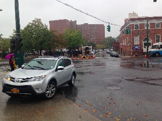
Intersection Wildey/Central/Valley
Descripción

Intersection Wildey/Central/Valley (Other side of Wallgreens Parking Lot)
Tarrytown and Sleepy Hollow Complete Streets, Healthy Places
updated 10/2014 by Tarrytown and Sleepy Hollow Green Map
updated 10/2014 by Tarrytown and Sleepy Hollow Green Map

Location:
Javascript is required to view this map.
Comentarios
Conexiones
Compare related sites, explore the related maps, find out about volunteering, how to get here and more. Soon, you will find ways to share this map here, too.
Every site using the same primary Icon on Open Green Map is automatically linked here. You can compare different approaches and solutions on this map and others around the world.
Choose a connections category from the list on the left.
Other Sites on Map
Related Sites Worldwide
- Brazil
- Reino Unido
- Colombia
- YogyakartaIndonesia
- CuritibaBrazil
- Santana de ParnaíbaBrazil
- Brazil
- Brazil
- FlorianópolisBrazil
- Brazil
- Brazil
- Brazil
- Estados Unidos
- New YorkEstados Unidos
- NatalBrazil
- FlorianópolisBrazil
- CaliColombia
- New York City
- Pereira
- Estados Unidos
- Brazil
- Estados Unidos
- Santana de ParnaíbaBrazil
- Brazil
- ClackmannanshireReino Unido
Multimedia

Intersection Wildey/Central/Valley

Impactos
No impacts have been left for this site yet - be the first!


