1801 NW 23rd Blvd
Gainesville
FL 32605
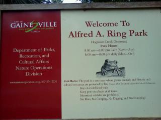
Alfred A Ring Park
Overview


A strip of dense slope forest along Hogtown Creek with old-growth trees and rare wildflowers along Appalachian-style ravines, Gainesville’s first linear park was a gift from a college professor, Alfred A. Ring, and opened in 1990.

Location:
Javascript is required to view this map.
Comments
Connections
Compare related sites, explore the related maps, find out about volunteering, how to get here and more. Soon, you will find ways to share this map here, too.
Every site using the same primary Icon on Open Green Map is automatically linked here. You can compare different approaches and solutions on this map and others around the world.
Choose a connections category from the list on the left.
Other Sites on Map
-
- Gainesville
- Gainesville
-
-
- Gainesville
- Gainesville
- Gainesville
- Gainesville
- Gainesville
Related Sites Worldwide
- Atlanta, Ga
- BaltimoreUnited States
-
- NY
- FlorianópolisBrazil
- MadisonUnited States
- kawkabaLebanon
- DetroitUnited States
- Australia
- PereiraColombia
- New Hartford
- Plan-les-OuatesSwitzerland
- United States
- Saint LouisUnited States
- Cluj-NapocaRomania
- Curitiba - PRBrazil
- New YorkUnited States
- Mount Holly Springs
- FifeUnited Kingdom
- San AntonioUnited States
- United States
- DetroitUnited States
- DetroitUnited States
- North CharlestonUnited States
- United States
Multimedia
Alfred A Ring Park


Impacts
No impacts have been left for this site yet - be the first!


