Dry Run Creek Trail
Vue d'ensemble


Dry Run Creek Trail
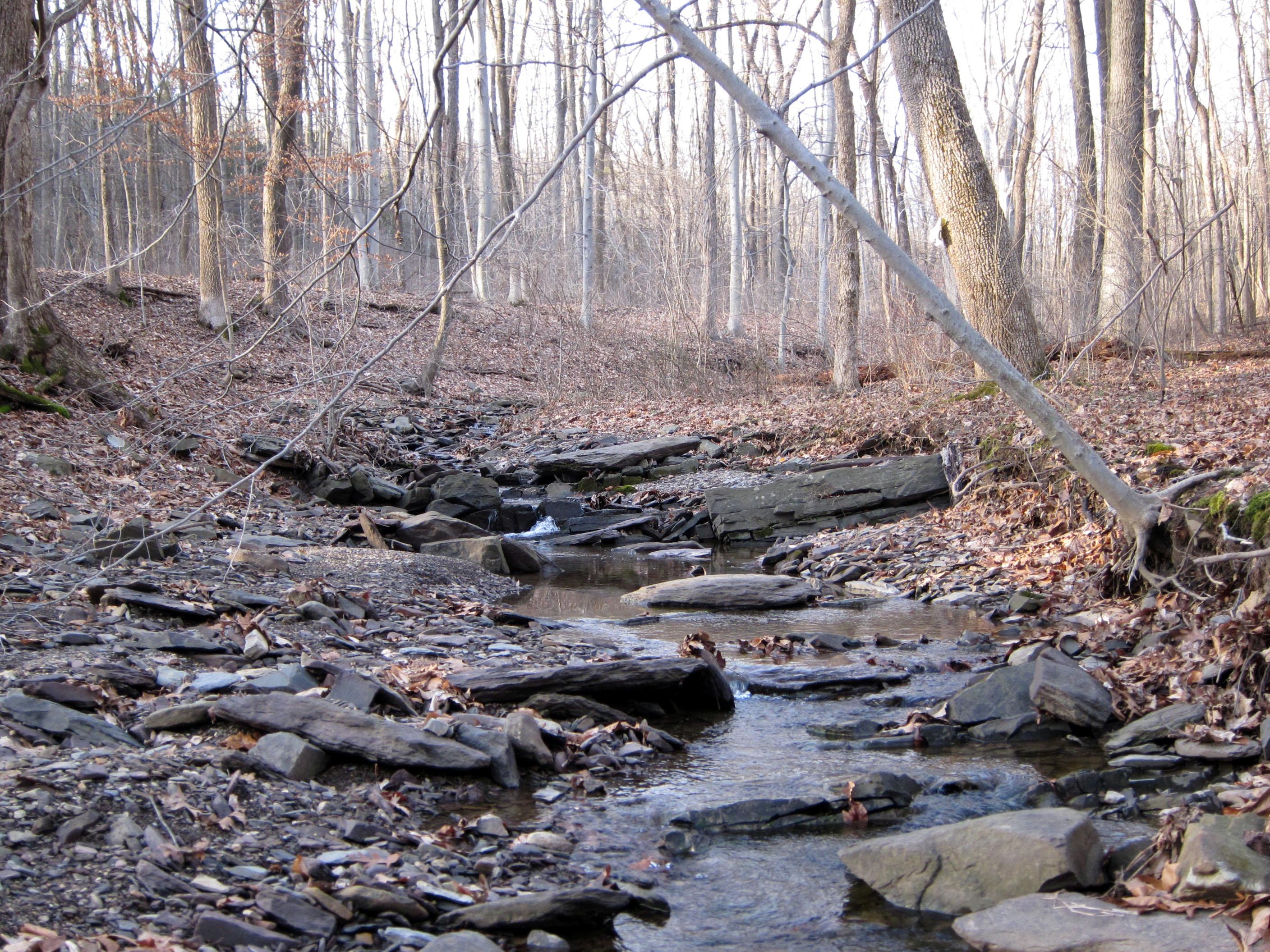
Trail Information: 1.2 miles, easy. The Dry Run Creek Trail descends through woods into the steep-sided valley of the Dry Run Creek, a tributary of Moore’s Creek. It then gradually climbs north, skirting the ledge-bound creek, and passing over three rustic bridges and an old dam. The trail climbs up out of the creek valley, sometimes on stone stairways, to its north end at Route 518. You can continue your hike on the Rockhopper Trail, which crosses Route 518 and continues 2.3 miles to the edge of Lambertville. Howell Living History Farm is nearby in Hopewell and offers horse drawn wagon rides, maple-sugaring and craft days for families on weekends. Restrooms are available at the Howell Living History Farm just south of the Dry Run Creek trailhead, when the Farm is open.
History: Dry Run Creek Trail was preserved by fee simple or by conservation easements. Hikers should stay on the marked trails and respect any private property signage along the way. Historic farms are located along Hunter Road and Woodens Lane that in some cases remain intact today. Signs of earlier land usage are evident along this walk. Old stone walls slice down the slopes toward the creek, and along the valley sides, suggesting earlier property boundaries and perhaps field clearances. Parts of the trail follow or cross an old woodland road, and at one point the trail, skirting an old wall, passes a line of ancient oaks.
Location: West Amwell Township, Hunterdon County, NJ 08530
Directions: From County Route 518, about one mile east of the center of Lambertville, turn south onto Hewitts Road and then immediately bear to the right on Woodens Lane. Proceed about one mile southward on Woodens lane to a small parking lot on the left (east). The lot is small, but parking is available along the east side of the road.
See our website for information about a D&R Greenway staff led walk on this trail in 2012: http://drgreenway.org/walks.htm#GreenwayWalks

Location:
Commentaires
Connections
-
-
-
-
-
-
- Princeton
-
-
-
- Mountainville, NY
-
- United States
- RichmondUnited States
- Gwynn OakUnited States
-
- VeniceUnited States
- ValparaisoChile
-
- FlorianópolisBrazil
- New YorkUnited States
- Stevens PointUnited States
- United States
- EhingenGermany
-
- Canada
- FlorianópolisBrazil
- QueensUnited States
- Staten IslandUnited States
- ModderfonteinSouth Africa
- New YorkUnited States
- NewfieldUnited States
- KirtlandUnited States
- MadisonUnited States
- FlorianópolisBrazil
Multimedia

Dry Run Creek Trail

Impacts
No impacts have been left for this site yet - be the first!


