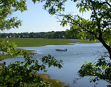
Moswetuset Hummock
Overview
This wooded area located at the intersection of East Squantum St. and Quincy Shore Dr. was the seat of the Sachem of the Massachusetts Indians. Chief Chickataubut was Sachem in 1621 when Captain Myles Standish and the Indian guide Squanto visited. Moswetuset is Algonquin and can be translated to mean "site of the great house" or "site of the great Chief's house." The site has not changed much since then. It is free and open to the public.
Location:
Javascript is required to view this map.
Comments
Connections
Compare related sites, explore the related maps, find out about volunteering, how to get here and more. Soon, you will find ways to share this map here, too.
Every site using the same primary Icon on Open Green Map is automatically linked here. You can compare different approaches and solutions on this map and others around the world.
Choose a connections category from the list on the left.
Other Sites on Map
- Quincy
-
-
- Quincy
Related Sites Worldwide
- United States
-
- United Kingdom
- United Kingdom
- United Kingdom
- CuritibaBrazil
- BaltimoreUnited States
- MontclairUnited States
- FlorianópolisBrazil
-
- ClevelandUnited States
- JerusalemIsrael
- RoodepoortSouth Africa
- United Kingdom
- United States
-
- Cluj-NapocaRomania
- United Kingdom
- United States
- United States
- United Kingdom
- DrydenUnited States
- Switzerland
- Lebanon
- TrentonUnited States
Impacts
No impacts have been left for this site yet - be the first!


 added by


