Ilabekken - a rehabilitied urban watercourse
![Water Feature: Display or drinking fountain, beautiful waterfall or natural pond. May simply celebrate water or offer a refreshing drink in an ecologically sound way. Water Feature](https://www.opengreenmap.org/sites/default/files/taxonomy_image/category_pictures_63.gif)
![Park/Recreation Area: Green space that offers a place to relax and play outdoors. May include sports fields, picnicking, running paths, canoe rental, or workout/play equipment, along with diverse vegetation and a pond, creek or other water feature. Park/Recreation Area](https://www.opengreenmap.org/sites/default/files/taxonomy_image/category_pictures_94.gif)
![Eco-Tour/Nature Walk: Marks the beginning of a hiking trail, guided tour starting point or an interesting walk. Maps, signage and information may be found here. Eco-Tour/Nature Walk](https://www.opengreenmap.org/sites/default/files/taxonomy_image/category_pictures_97.gif)
![Aquatic Habitat: Includes fresh and saltwater ecosystems, and the many kinds of wildlife that flourish in the marine environment. Aquatic Habitat](https://www.opengreenmap.org/sites/default/files/taxonomy_image/category_pictures_86.gif)
![Natural Corridor/Greenway: Often follows along a river or streambed, ravine or steep hill, disused rail bed or roadway. May indicate a wildlife corridor for land animals that is left in a natural state, with native plants to shelter them. Often have paths for running, cycling, skating, etc. Natural Corridor/Greenway](https://www.opengreenmap.org/sites/default/files/taxonomy_image/category_pictures_66.gif)
![Eco-Design/Planning Feature: Exciting design features including public transport stations, plazas, integrated native plantings and street furniture such as kiosks, benches, fountains, or lighting that use materials and energy efficiently, contributing to the streetscape. May be an area planned for ecological soundness or use sustainable infrastructure guidelines. Eco-Design/Planning Feature](https://www.opengreenmap.org/sites/default/files/taxonomy_image/category_pictures_68.gif)
![Cleaned-Up/Rebuilt Site: A previously contaminated (or disaster) area that has been restored and remediated for safe public use, according to environmental standards. Can include brownfield remediation sites, development sites with soil/groundwater cleanup efforts, or reclaimed cleaned-up land such as urban parks and gardens. Cleaned-Up/Rebuilt Site](https://www.opengreenmap.org/sites/default/files/taxonomy_image/category_pictures_69.gif)
Overview
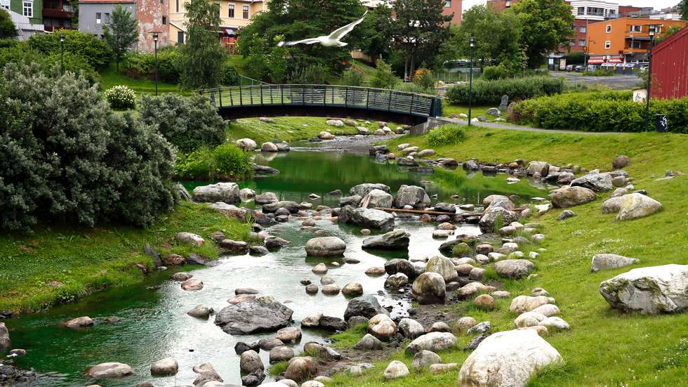
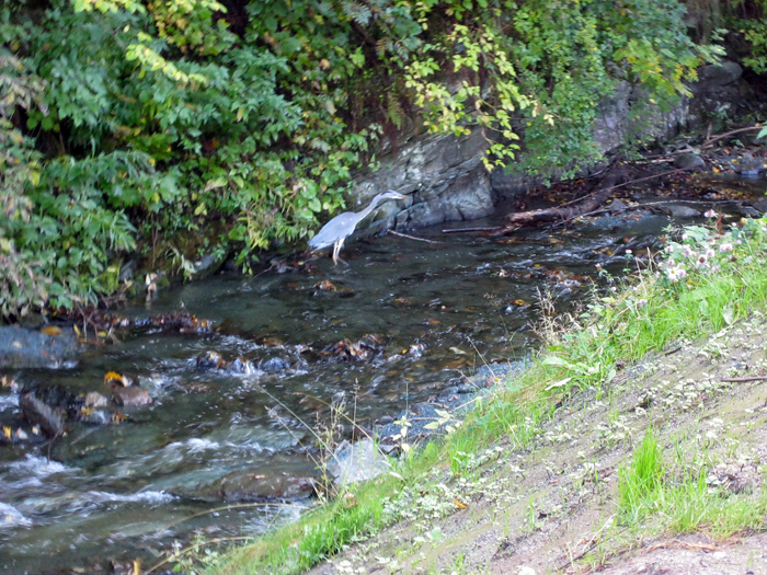
Until 2008 the Ila stream had run underground in pipes and was heavily polluted. Wastewater from houses and factories was discharged directly into the stream. Before the twentieth century the stream had been home for sea trout and many other species, but this habitat was destroyed by poor water quality and the burial of the watercourse. Now the Ilabekken is rehabilitated and opened again. The water quality is restored and sea trout have returned.
The rehabilited and revitalized Ila valley is now a unique urban wilderness area. It is a popular site for walking and recreation, with the lower stretch of the stream running through parkland. The rehabilitated watercourse has been engineered to withstand severe flooding, securing the area against the extreme precipitation predicted by climate-change modelling.
Location:
Comments
Connections
n/a
- Canada
- SewellUnited States
- South Africa
-
- United States
- LawrencevilleUnited States
- RichmondUnited States
- ConstantaRomania
- HaddonfieldUnited States
- DosquebradasColombia
-
- United States
-
- Brazil
-
- VerbierSwitzerland
- Belize
- EnglewoodUnited States
- Baltimore, MDUnited States
- North VeniceUnited States
- Baltimore, MDUnited States
- GibbstownUnited States
- Trenton / Port SevernCanada
- Jefferson CityUnited States
- High Falls
Multimedia
![](https://opengreenmap.org./sites/default/files/user_upload/teisendammen_ilabekken.jpg?1373883911)
Teisendammen_Ilabekken
Impacts
No impacts have been left for this site yet - be the first!