Gowanus Canal
Overview
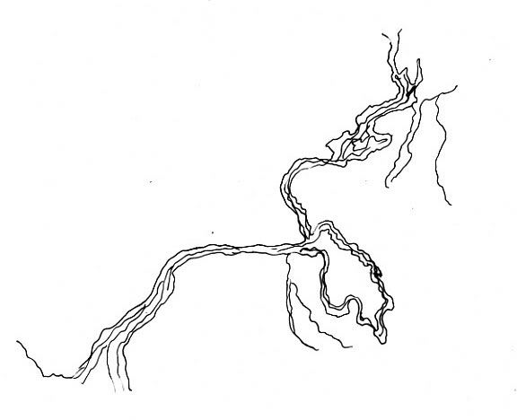

The Gowanus Canal was once a rambling creek.

Location:
Javascript is required to view this map.
Comments (1)
Connections
Compare related sites, explore the related maps, find out about volunteering, how to get here and more. Soon, you will find ways to share this map here, too.
Every site using the same primary Icon on Open Green Map is automatically linked here. You can compare different approaches and solutions on this map and others around the world.
Choose a connections category from the list on the left.
Other Sites on Map
- Brooklyn
- Brooklyn
Related Sites Worldwide
-
- NewtonUnited States
- QuincyUnited States
- SewellUnited States
- SummitUnited States
- BaltimoreUnited States
- United States
- Baltimore, MDUnited States
- Mogi MirimBrazil
- BridgewaterUnited States
- United States
- Canada
- HudsonUnited States
-
- RichmondUnited States
- DahlonegaUnited States
- RichmondUnited States
- MountainsideUnited States
- BaltimoreUnited States
- Cape May Court HouseUnited States
- Canada
- RandolphUnited States
- Saint Lucia
-
- LondonCanada
Multimedia

 added by
 Impacts
No impacts have been left for this site yet - be the first!


