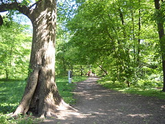
Cold Spring Lane East of Wilmslow Road
Baltimore
MD 21210
Stony Run Park and Walking Path
Visão geral
- 0 comentários
- share this site
Stony Run Park is a linear stream valley park that stretches from Northern Parkway to Cold Spring Lane, parallel to Wilmslow Road and cutting between neighborhood and private schools north of Wyndhurst. The Stony Run Walking Path extends down into Wyman Park and ultimately connects to the Jones Falls Trail.
Location:
Javascript is required to view this map.
Comentários
Connections
Compare related sites, explore the related maps, find out about volunteering, how to get here and more. Soon, you will find ways to share this map here, too.
Every site using the same primary Icon on Open Green Map is automatically linked here. You can compare different approaches and solutions on this map and others around the world.
Choose a connections category from the list on the left.
Other Sites on Map
- Baltimore
- Baltimore
- Baltimore
- Baltimore
- Baltimore
- Baltimore
- Baltimore
- Baltimore
-
-
Related Sites Worldwide
- FifeUnited Kingdom
- CaliColombia
- United States
- BronxUnited States
- United States
- AustinUnited States
- Taiwan
- Santana de ParnaíbaBrazil
- Fort AtkinsonUnited States
- LansingUnited States
- AustinUnited States
- VeniceUnited States
- United States
- EspooFinland
- Cluj-NapocaRomania
- MonseyUnited States
- Cluj-NapocaRomania
- OaklandUnited States
- OaklandUnited States
- SarasotaUnited States
- SarasotaUnited States
- VeniceUnited States
- United States
- San FranciscoUnited States
- OaklandUnited States
Multimedia

Stony Run Path

Impacts
No impacts have been left for this site yet - be the first!


 added by


