1001 NW 34th St
Gainesville
FL 32605
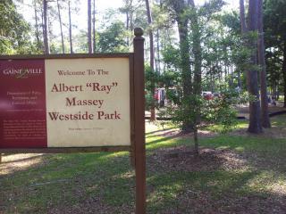
Albert "Ray" Massey (Westside) Park
Overview


Amenities: Parking, Restrooms, Basketball Courts w/ Light, Diamond Fields for Baseball/Softball, Racquetball Courts, Tennis Courts w/ Light, Unpaved Trail, Picnic Tables, Grills, Pavilion, Playground, Dogs Allowed w/ Leash, Skate Park, Westside Pool, Fitness Stations: set along the trail for pull-ups and parallel bar

Location:
Javascript is required to view this map.
Comments
Connections
Compare related sites, explore the related maps, find out about volunteering, how to get here and more. Soon, you will find ways to share this map here, too.
Every site using the same primary Icon on Open Green Map is automatically linked here. You can compare different approaches and solutions on this map and others around the world.
Choose a connections category from the list on the left.
Other Sites on Map
- Gainesville
- Gainesville
-
- Gainesville
- Gainesville
- Gainesville
- Gainesville
- Gainesville
- Gainesville
- Gainesville
Related Sites Worldwide
- New York CityUnited States
- Canada
- ToomsubaUnited States
- BaltimoreUnited States
- CuritibaBrazil
- FifeUnited Kingdom
- BrooklynUnited States
- United States
- United States
- Taiwan
- DetroitUnited States
- Carlisle
- United States
-
- United Kingdom
- IthacaUnited States
- United Kingdom
- Brazil
- United States
- NY
-
- BaltimoreUnited States
- CaliColombia
- Brazil
- United Kingdom
Multimedia
Albert "Ray" Massey (Westside) Park


Impacts
No impacts have been left for this site yet - be the first!


