Cali
VDC
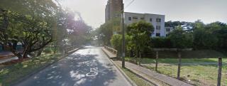
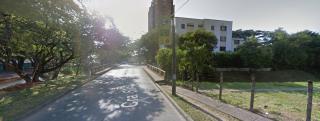
Desembocadura Río Cañaveralejo al Canal de la Cra 50
Descripción


Desembocadura Río Cañaveralejo al Canal de la Cra 50

Location:
Javascript is required to view this map.
Comentarios
Conexiones
Compare related sites, explore the related maps, find out about volunteering, how to get here and more. Soon, you will find ways to share this map here, too.
Every site using the same primary Icon on Open Green Map is automatically linked here. You can compare different approaches and solutions on this map and others around the world.
Choose a connections category from the list on the left.
Other Sites on Map
-
- Cali
- Cali
- Cali
- Cali
- Cali
- Cali
- Cali
- Cali
- Cali
Related Sites Worldwide
- Colombia
-
-
- FlorianópololisBrazil
- Colombia
- United States
-
-
- Colombia
- Santana de ParnaíbaBrazil
- Santana de ParnaíbaBrazil
- United States
- Santana de ParnaíbaBrazil
- Colombia
- Jersey CityUnited States
-
-
- United States
- United States
-
- Colombia
-
-
- Santana de ParnaíbaBrazil
-
Multimedia
Desembocadura Río Cañaveralejo al Canal de la Cra 50

Impactos
No impacts have been left for this site yet - be the first!


