L'Arve
Vue d'ensemble

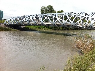
Fleuve qui traverse la frontière entre la Suisse et la France, qui prend sa source dans le massif du Mont Blanc.

Location:
Javascript is required to view this map.
Commentaires
Connections
Compare related sites, explore the related maps, find out about volunteering, how to get here and more. Soon, you will find ways to share this map here, too.
Every site using the same primary Icon on Open Green Map is automatically linked here. You can compare different approaches and solutions on this map and others around the world.
Choose a connections category from the list on the left.
Other Sites on Map
Related Sites Worldwide
- Cherry HillUnited States
- United States
-
- MillvilleUnited States
- Cherry HillUnited States
- United States
- RochesterUnited States
- United States
- JerusalemIsrael
- EnglewoodUnited States
-
- United States
- United States
- Belize
-
-
- NatalBrazil
- BaltimoreUnited States
- Canada
-
- Santana de ParnaíbaBrazil
-
- BaltimoreUnited States
- RichmondUnited States
-
Multimedia

L'Arve

Impacts
No impacts have been left for this site yet - be the first!


