Midlands Conservancies Forum
![Native Forests/Plants: Flora that is indigenous in the region, sometimes called old growth, heirloom or indigenous species. Native species requires less water and care than exotic imports, and usually attract more birds, bees and butterflies, and help the cycle of life stay in balance. May include a master gardener, permaculturalist or horticulturalist or information center. Native Forests/Plants](https://www.opengreenmap.org/sites/default/files/taxonomy_image/category_pictures_75.gif)
![Public Forest/Natural Area: Natural Reserve, National Parks, Regional Parks, other parks and public forests, even private land that has been set aside for conservation. Balance your emphasis of forests with parklands to discourage the over-use of natural areas. Public Forest/Natural Area](https://www.opengreenmap.org/sites/default/files/taxonomy_image/category_pictures_73.gif)
![Significant Habitat: Notable wildlife ecosystem or natural breeding area that may be rare or especially beautiful and rich. Significant Habitat](https://www.opengreenmap.org/sites/default/files/taxonomy_image/category_pictures_82.gif)
![Wildlife Habitat: Native environment for animals and the plants that sustain them. Can represent native natural environments, or protected areas such as park reserves where larger animals and other wildlife can be found. Wildlife Habitat](https://www.opengreenmap.org/sites/default/files/taxonomy_image/category_pictures_83.gif)
![Wetlands: May be on an official protection list, as wetlands are important habitats and useful for water cleaning and protection from storm surges. May be natural, reconstructed or artificial. Wetlands](https://www.opengreenmap.org/sites/default/files/taxonomy_image/category_pictures_64.gif)
![Drinking Water Source: May be used to show the source for your drinking water, reservoirs, and major elements of the water system, as well as water purity and conservation information. Icon can be used in or with a line to indicate major underground pipelines, spigots or drinking fountains. Drinking Water Source](https://www.opengreenmap.org/sites/default/files/taxonomy_image/category_pictures_65.gif)
Overview
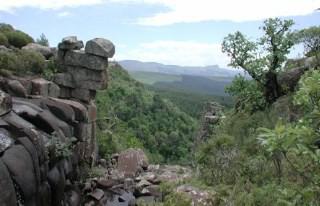
Our coalition of 14 Conservancies, is focussed on biodiversity conservation to ensure long-term environmental sustainability in the area. Regular walks, talks, articles and workshops on a wide range of topics, inspire, motivate and challenge our members, partner organisations and the public to value and protect the eco-systems on which we all rely.
Location:
Javascript is required to view this map.
Comments
Connections
Compare related sites, explore the related maps, find out about volunteering, how to get here and more. Soon, you will find ways to share this map here, too.
Every site using the same primary Icon on Open Green Map is automatically linked here. You can compare different approaches and solutions on this map and others around the world.
Choose a connections category from the list on the left.
Other Sites on Map
- Impendle
- Nottingham Road
- Howick
-
- Dargle
- Pietermaritzburg
Related Sites Worldwide
- Clinton
- Cape TownSouth Africa
- BaltimoreUnited States
- JacksonvilleUnited States
- Longboat KeyUnited States
- United Kingdom
- CuritibaBrazil
- FreevilleUnited States
- United States
- United Kingdom
- CarolineUnited States
- Taiwan
- United States
- OspreyUnited States
- CamdenUnited States
- United States
- LanseUnited States
- United States
- United States
- Saint LouisUnited States
-
- New YorkUnited States
- Lebanon
- SwanseaUnited Kingdom
-
Multimedia
![](https://opengreenmap.org./sites/default/files/imagecache/320max/user_upload/7c2768ac5d860d14339edcffd9c2d6ce.jpg)
Midlands Conservancies Forum
Impacts
No impacts have been left for this site yet - be the first!