Cherry Clinton Playground Drinking Fountain
Översikt


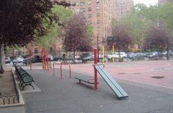
The land now occupied by Cherry Clinton Playground was owned by the Board of Education through the first few decades of the 20th century, and was used as the Seventh Ward Athletic Field until jurisdiction was transferred to Parks on June 16, 1938. The park was opened to the public on April 3, 1940 and included four paddle tennis courts, four handball courts, and a basketball-volleyball court. For years, the small park situated at the intersection of Clinton, Cherry, and Water Streets was known simply as "Playground." Not until 1985 was the park named Cherry Clinton Playground after the streets which border it to the north and west.
The park also has a water fountain accesible to the public.

Location:
Kommentarer
Kopplingar
-
- Lebanon
- Delaware CountyUnited States
-
- GenèveSchweiz
-
- Brasilien
- United States
-
- Lebanon
-
- Brasilien
-
- FlorianopolisBrasilien
- Lebanon
-
- GenèveSchweiz
-
-
-
- Kanada
- Brasilien
- Taiwan
-
- RichmondUnited States
Multimedia

Cherry Clinton Playground Drinking Fountain

Påverkan
Ingen påverkan har registrerats för denna plats än - du kan bli först!


